
Seminar Project
Instructor:
Yanni A. Loukissas
Cornell Department of Architecture
CLICK HERE for the application.
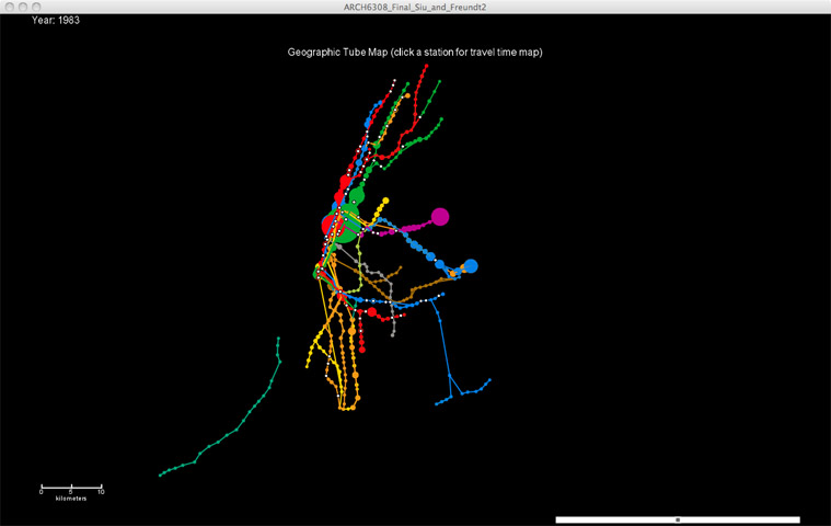
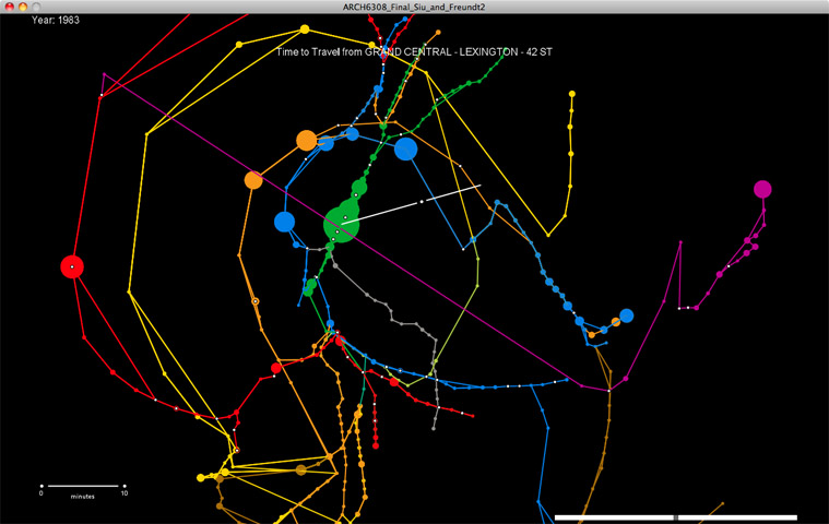
Radial New York City Subway Map is an application that reorganises the NYC subway system according to time. The geographical tube map is distorted as the user clicks a station, which re-renders the timezones to reflect that station as the origin. Shortest paths are used to place the other stations, where the radius is proportional to the traveling-time. The application is an adaptation from Tom Carden’s Travel Time Tube Map for the city of Boston. Radial NYC Subway Map parses MTA raw data relating to the geographical location of the stations, the possible routes and lines that connect them and the time it takes considering the stops and line changes required by the traveller. Additional information relating to the ridership (ie The number of passengers who use a certain station or line) was also included, so the application displays the fluctuation of station use from 1960 to 2006.