
Seminar Project
Instructor:
Yanni A. Loukissas
Cornell Department of Architecture
CLICK HERE for the application.
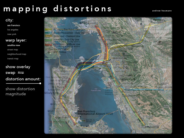
This project looks at the distortions inherent in the creation of simplified or rationalized maps, in particular public transit maps. It displays maps from 3 cities: San Francisco, Los Angeles, and New York. Each city has 4 maps: a satellite view, a street map, a composite neighborhood map, and a transit map against which the others are compared. The application allows the user to warp each geographically accurate map to align with the rationalized transit maps. Similarly, the transit map can be warped to match the true geographic projection. This allows a realtime visualization of the invisible distortions present in each transit map - what it expands, contracts, and omits. There is also an option to overlay a regular grid of dots, sized with respect to the amount that particular point is distorted in the transformation. The warp also affects this grid, and the visible changes in density further bring out the distortions.